
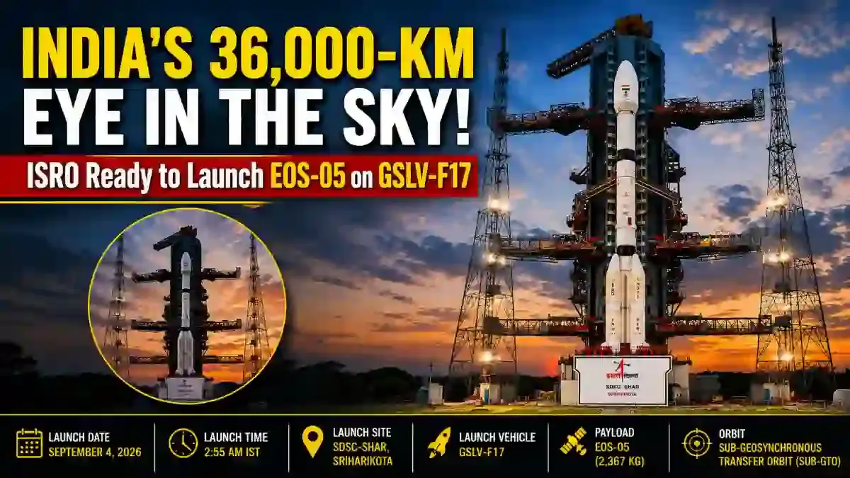

Sriharikota: Marking a transformative milestone in space-based surveillance and Earth observation, the Indian Space Research Organisation (ISRO) is in the final countdown stages for the launch of the GSLV-F17 / EOS-05 mission from the Satish Dhawan Space Centre (SDSC-SHAR) in Sriharikota. Scheduled to lift off on September 4, 2026, at 02:55 AM IST from the Second Launch Pad (SLP), the Geosynchronous Satellite Launch Vehicle will inject the advanced EOS-05 spacecraft into a Sub-Geosynchronous Transfer Orbit (Sub-GTO). Weighing approximately 2,367 kg, EOS-05 stands as India's first-ever optical imaging satellite designed to operate from a high Geosynchronous Orbit (GEO) roughly 36,000 km above Earth, unlocking continuous real-time observation over the entire subcontinent. For in-depth reports on space missions, scientific breakthroughs, and defense tech, visit our space and defense desk.
The GEO Paradigm Shift: LEO vs. Geosynchronous Imaging
For decades, standard Earth observation satellites—including India's Cartosat, Resourcesat, and RISAT constellations—have operated from Low Earth Orbit (LEO) at altitudes between 500 km and 800 km. Because LEO satellites orbit Earth in approximately 90 minutes while the planet rotates beneath them, they only capture fleeting snapshots of a given coordinates, resulting in revisit cycles that can take days or weeks.
In contrast, EOS-05 will occupy a permanent orbital slot in a high geosynchronous orbit (~36,000 km). At this orbital altitude, the satellite's orbital period precisely synchronizes with Earth's 24-hour rotational period. This creates a continuous 'hovering gaze' over the Indian landmass and adjoining seas, allowing round-the-clock imagery refresh rates unavailable through conventional polar orbits.
High-Tech Payloads and Strategic Defense Applications
EOS-05 is equipped with state-of-the-art optical and multispectral imaging suites that offer versatile strategic utility:
- Record Optical Resolution: The spacecraft carries high-resolution multispectral cameras capable of delivering a 42-metre spatial resolution—setting a benchmark as the sharpest optical imaging instrument ever deployed in geostationary orbit globally.
- Disaster Mitigation & Meteorology: With near real-time image updates, meteorological authorities can monitor cyclonic genesis in the Bay of Bengal and Arabian Sea, map rapid forest fires, trace sudden Himalayan cloudbursts, and assess flood inundation boundaries as they develop.
- Border & Maritime Awareness: The persistent vantage point strengthens continuous surveillance along sensitive Himalayan border frontiers, India's Exclusive Economic Zone (EEZ), and vital trade choke points across the northern Indian Ocean.
Mission Specifications & Launch Configuration
Overcoming the Cryogenic Anomaly: The GISAT-1 Redemption
EOS-05 (initially conceived as GISAT-1A) serves as the direct replacement for GISAT-1 (EOS-03), which was lost on August 12, 2021, during the GSLV-F10 flight due to a failure in the Cryogenic Upper Stage (CUS) fuel pressurisation system. Following extensive investigation, ISRO engineers redesigned the CUS-15 pressurisation valves, enhanced telemetry sensors, and conducted comprehensive hot-fire tests on the ground. A successful orbital injection with GSLV-F17 will officially close that chapter and restore full operational momentum to India's launch calendar.
Frequently Asked Questions
Ketan
adminPassionate journalist and digital news editor committed to delivering accurate, timely, and fact-checked news.
Related Articles




Latest Articles

Unfathomable Tragedy: A Mother's Despair and a Chi...
Sep 04, 2026
Bittu Tabahi Cleans Ajnar River in MP Single-Hande...
Sep 04, 2026
2026 Tata Curvv Series X Debuts at Rs 10 Lakh: Tri...
Sep 04, 2026
Meta Ads Overhaul: Advantage+ Mandate, Andromeda &...
Sep 04, 2026
Comments (0)
Leave a Comment
No comments yet. Be the first to comment!